Swansea Bay is a mecca for walking enthusiasts
The Swansea Bay area has an excellent network of walks including the local sections of the Wales Coast Path around Gower and Port Talbot. The valleys verging on Port Talbot, Neath and Swansea have interesting walking opportunities.
Take a closer look at whats on offer
Walking in Gower
Gower Coast Path
We provide detailed information on seven sections of this iconic coastal footpath together with the best way to access using public transport.
-
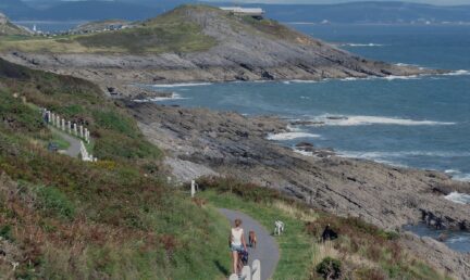
caswell bay - oystermouth
This walk takes advantage of some magnificent cliff and beach scenery through Langland and Bracelet Bays, Mumbles Head and the Victorian resort of Mumbles.Discover more -

caswell bay - PENNARD CLIFFS
This beautiful section of the Coast Path takes in one of the most spectacular sections of the Gower ‘Area of Outstanding Natural Beauty’ coastline. It follows the winding cliff top path from Caswell Bay to Pwlldu Bay before rounding Pwlldu Head with its great coastal views.Discover more -
Pennard Cliffs - Oxwich Bay
This section of the Coast Path, crossing Pennard Burrows to Three Cliffs and Oxwich Bay is quite different and distinctive in character, with woodland, dune and beach sections.Discover more -
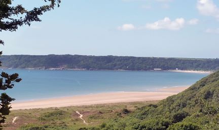
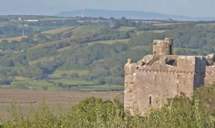
Oxwich Bay - Port Eynon
This is another dramatic section of the Coast Path, this time following the great headland around Oxwich Point, with more spectacular cliff and coastal scenery.Discover more -
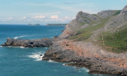
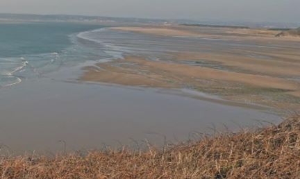
Port Eynon - Rhossili
This section of the Coastal Path forms one of the most beautiful and famous walks in the Gower Peninsula, taking in spectacular coastal and rugged scenery culminating in the iconic Worm’s Head.Discover more -
Llanmadoc - Llanrhidian
An interesting walk hugging the coastline and Llanrhidian Salt Marshes.Discover more -
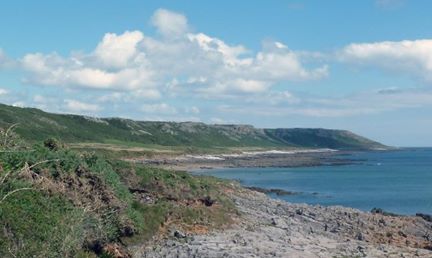
Llanmadoc - Rhossili
A challenging walk around the cliffs of north Gower and along spectacular Rhossili beach.Discover more
This is Gower App
There are numerous other walks in all parts of Gower and information on many can be obtained by using the This is Gower App (iOS Users (Apple) / Android users)
Wales Coast Path App
The official app for the Wales Coast / Wales Coastal Path – iOS Users (Apple) / Android users
The National Trust
The National Trust has a series of interesting walks in the Peninsula, check them out below.
Visit websiteThe Gower Way
The Gower Way long distance footpath was created by the Gower Society in association with Swansea Ramblers. It goes from Rhossili on the western tip of Gower to Penlle’r Castell in the ancient Lordship of Gower north of Swansea
Visit websiteWALKING IN THE CITY
The Coast Path (NCN 4) offers great walking along the coastal strip of Swansea Bay right through to Mumbles and from Blackpill to Gowerton.
Elsewhere in the city are shorter routes:
Uplands and Cwmdonkin Park
River Tawe trail: Marina to Liberty Stadium
WALK TO MUMBLES TRAFFIC FREE
The coastal path has separate pedestrian and cycle lanes all the way from Swansea to Mumbles. This popular amenity is part of the Wales Coast Path and is dual use to Mumbles Pier. The walking trail continues round the coast through Bracelet and Langland Bays to Caswell Bay and the Gower peninsula.
Walking in north Swansea and Mawr
The Gower Way long distance footpath was created by the Gower Society in association with Swansea Ramblers It runs from Rhossili on the western tip of Gower to Penlle’r Castell in the ancient Lordship of Gower north of Swansea.
The Heart of Wales Line Trail 19.5km from Pontarddulais to Llanelli via Loughor is part of a developing 200km trail parallel to the Heart of Wales railway.
There are other interesting walks in the Mawr area leading to wild and beautiful places. Download the PDFs below:
Craig Fawr Walk from Pontarddulais
Cwm Clydach Walk from Craig Cefn Parc
Country Walk Pontlliw to Craig Cefn Parc via Felindre
Walking in Neath Port Talbot and the Valleys
There is a lot of good walking in the Neath Port Talbot area. The inland route of the Wales Coast Path between Margam and Briton Ferry is spectacular and challenging with fantastic views over Margam Park, the Steelworks and Swansea Bay.
Neath Port Talbot Ramblers will provide more information and a programme of organised walks
-

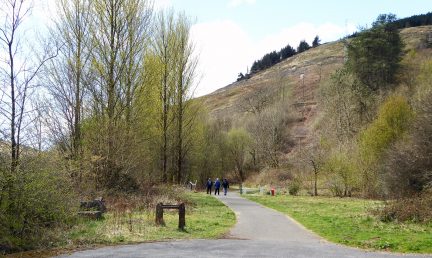
Cwm Dyffryn Trail
The Port Talbot Railway & Docks Company line linked Garw and Llynfi Valley collieries to Port Talbot docks and this walk is on the most attractive part of that route, through the deeply wooded Cwm Dyffryn.Discover more -
Glyncorrwg to Cymmer Trail
The Corrwg Valley and its many collieries were the original reason for the South Wales Mineral Railway which connected the valley to Briton Ferry docks on a convoluted routing via Cymmer, Tonmawr and Crythan Point.Discover more -
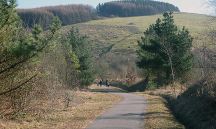
Pontrhydyfen to Cymmer Trail
This trail follows the course of the former Rhondda and Swansea Bay (R&SB) railway on a largely level course along this spectacular valley. Over recent decades the once heavily industrialised landscapes of the Afan Valley have been transformed to an area which - reclaimed by forestry and nature - has become a paradise for walkers, cyclists and bird watchers.Discover more -

Richard Burton Trail
The Richard Burton Trail opened in 2011 commemorating the great Welsh actor and film star (1925-1984). Richard, son of a miner, was born in Pontrhydyfen and grew up in Taibach, Port Talbot; he took part in drama productions with the local YMCA then moved to London to become a great Shakespearean actor and finally a world famous Hollywood film star.Discover more -
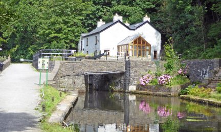
Aberdulais Historic Trail
Aberdulais was one of many industrial hotspots in centuries past and a major transport interchange. The trail links Tonna via the Neath and Tennant Canals, the Tinworks and Waterfall site.Discover more -
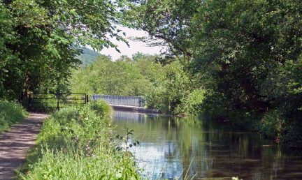
Vale of Neath Canal Trail
The Basin was the junction between the Neath (Glynneath-Briton Ferry) and the Tennant (Aberdulais-Port Tennant) Canals; also a loading and transfer point for freight traffic. Commercially, the Neath Canal was carrying 150000 tonnes of coal by 1820 rising to a peak of 200000 tonnes, mostly transferring to the Tennant Canal.Discover more -
Banwen Roman and Waterfall Trail
Banwen, best known as a former mining village, has a fascinating history long before mining - over 2000 years. The village is close to the ancient Roman fort of Ricus, first after Nidum (Neath) on the ‘A470’ of the times, the road between Nidum and Segontium (Caernarfon).Discover more -
Cilybebyll to Pontardawe Trail
The Cilybebyll estate was established in the 15th century and after development by various families, by 1838 was recorded as having the largest land holding in the district. The main house, Plas Cilybebyll, was redeveloped in 1840 by Henry Leach, creating a south-facing Victorian facade on the property.Discover more -

Clydach to Pontardawe Trail
The area around Pontardawe has an interesting transport history and fortunately the Swansea Canal, an early form of bulk transport infrastructure, is still largely extant. Less fortunate for railways in that all trace of the Midland Railway at Pontardawe has been obliterated by road and supermarket development.Discover more -

Pontardawe to Ystalyfera Trail
The area around Pontardawe has an interesting transport history and fortunately the Swansea Canal, an early form of bulk transport infrastructure, is still largely extant. Less fortunate for railways in that all trace of the Midland Railway at Pontardawe has been obliterated by road and supermarket development.Discover more